The Bruce Trail is Canada's oldest and longest marked footpath, stretching 900 kilometres from Niagara Falls to the tip of the Bruce Peninsula. The sections near Blue Mountain include some of the trail's most scenic terrain, with dramatic Escarpment views, diverse forests, and accessible trailheads that make day hiking convenient and rewarding. For other routes in the area, see our roundup of the best hiking trails near Blue Mountain.
Understanding the Bruce Trail
Trail Markings
The Bruce Trail uses a simple but effective marking system:
- White blazes — Mark the main Bruce Trail route
- Blue blazes — Mark side trails that lead to viewpoints, parking areas, or alternative routes
- Double blazes — Indicate a change in direction. The upper blaze is offset in the direction of the turn.
Trail Difficulty
The Bruce Trail near Blue Mountain ranges from moderate to challenging. The Niagara Escarpment creates significant elevation changes, and the trail surface is often rocky, rooted, and uneven. Sturdy footwear with ankle support is strongly recommended.
Trail Etiquette
- Stay on marked trails to protect sensitive Escarpment ecology
- Yield to uphill hikers on narrow sections
- Pack out everything you bring in
- Keep dogs leashed (where dogs are permitted)
- Leave wildflowers, rocks, and artifacts undisturbed
Key Trail Sections Near Blue Mountain
Loree Forest Section
Length: 5 kilometres one way Difficulty: Moderate Trailhead: Accessible from Grey Road 19
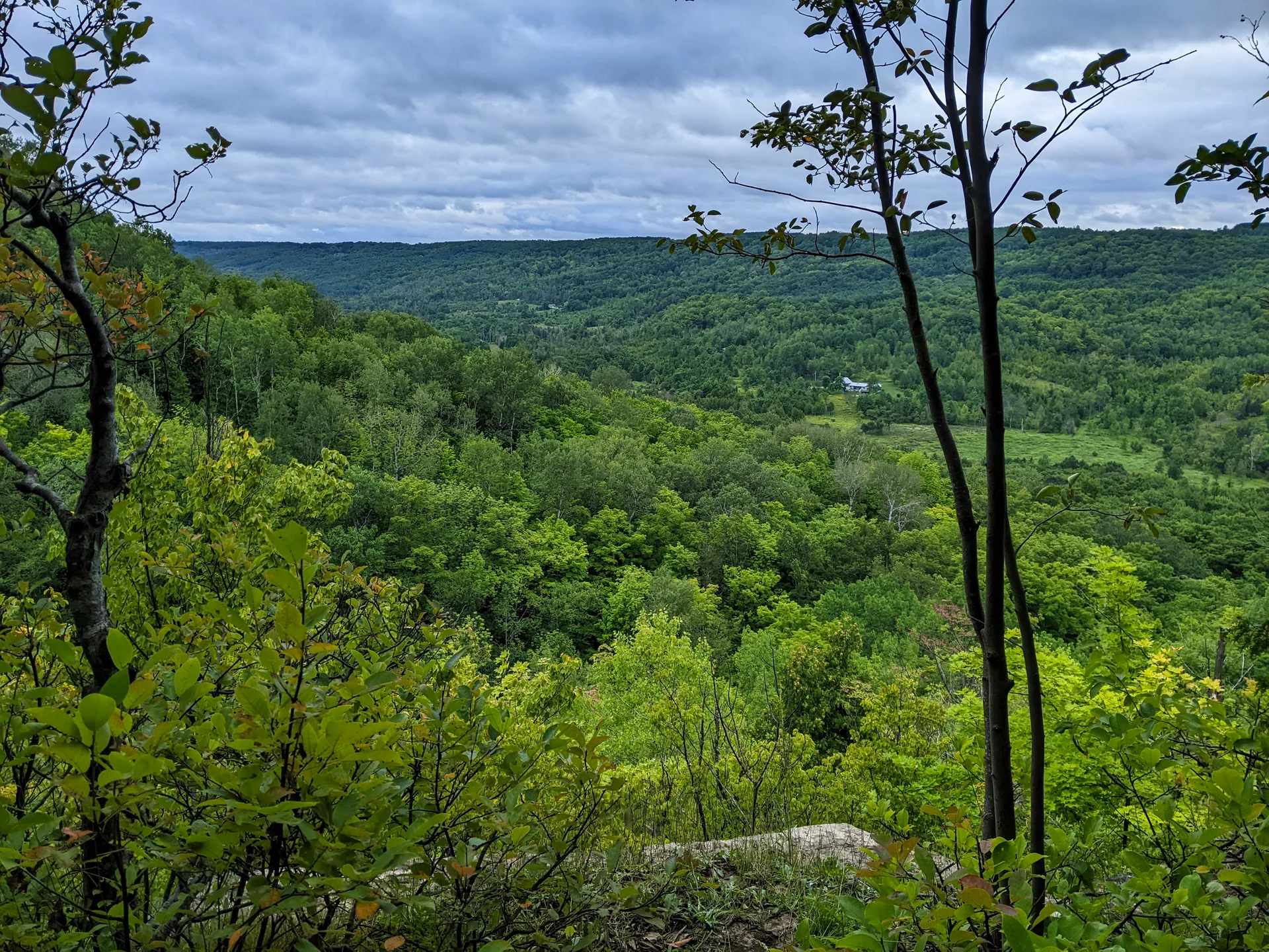
This section winds through mature hardwood forest along the Escarpment edge. The trail offers several viewpoints looking out over the lowlands and Georgian Bay. The forest floor is rich with wildflowers in spring, and the fall colours are spectacular.
Highlights: - Old-growth hardwood forest with impressive canopy - Multiple Escarpment-edge viewpoints - Diverse bird life (look for warblers in spring, hawks in fall) - Relatively well-maintained trail surface
Pretty River Valley Section
Length: 7 kilometres loop (using side trails) Difficulty: Moderate to challenging Trailhead: Accessible from County Road 124
This demanding section descends into the Pretty River Valley, crosses the river, and climbs back up the Escarpment on the other side. The elevation change is significant and the trail can be steep in places.
Highlights: - Deep valley views from the Escarpment rim - River crossings (can be tricky during high water) - Remote feeling despite proximity to the road - Challenging terrain that rewards fitness
Duncan Escarpment Section
Length: 4 kilometres one way Difficulty: Moderate Trailhead: Accessible from Duncan area
A scenic section that follows the Escarpment edge with periodic viewpoints. The trail passes through mixed forest and along rock outcrops that provide natural resting spots.
Highlights: - Consistent Escarpment views - Rock formations and geological features - Quieter than more popular sections
Kolapore Section
Length: Various loops from 3 to 12 kilometres Difficulty: Moderate to challenging Trailhead: Accessible from Kolapore area roads
The Kolapore Uplands area offers a network of trails through ecologically significant forest. The terrain is rolling with rocky sections, and the area has a genuine backcountry feel.
Highlights: - One of southern Ontario's most ecologically significant forests - Backcountry atmosphere unusual for this region - Excellent cross-country skiing in winter - Diverse flora and fauna
Planning Your Hike
What to Bring
- Sturdy hiking boots with ankle support
- At least 1 litre of water per person (more for longer hikes)
- Snacks and lunch for hikes over 2 hours
- Rain jacket (weather on the Escarpment can change quickly)
- Trail map (download the Bruce Trail app or carry a paper map)
- Sun protection (hat, sunscreen)
- Insect repellent (May through September)
- First aid kit
- Headlamp (as a precaution)
Seasonal Considerations
Spring (April to May): Trails can be very muddy, especially in low-lying areas. Waterproof boots are essential. Wildflowers begin appearing in May.
Summer (June to August): Lush forest canopy provides shade. Insects are at their worst in June. Carry plenty of water and insect repellent.
Fall (September to October): The best hiking season. Comfortable temperatures, stunning colours, and firm trail surfaces. The most popular time on the trail. Our fall hiking guide covers the colours.
Winter (November to March): Sections of the trail are hikeable with proper footwear (ice cleats or microspikes recommended). Ice and snow can make steep sections dangerous. Daylight hours are limited. For groomed options, see our cross-country skiing and snowshoeing guide.
Navigation
The Bruce Trail is well-marked with white blazes, but intersections with other trails can be confusing. We recommend:
- The Bruce Trail app provides GPS mapping and trail information
- Bruce Trail Reference guides (available at local bookstores) provide detailed descriptions of each section
- Download offline maps as cell service can be spotty on the Escarpment
Safety
- Tell someone your planned route and expected return time
- Be aware of cliff edges, especially near viewpoints
- Watch for slippery surfaces (wet rocks, ice, fallen leaves)
- Check weather forecasts before heading out
- Start your hike early to ensure you finish before dark
Hiking and Staying at Blue View Chalets
Blue View Chalets provides the ideal base for Bruce Trail hiking. Our chalets are centrally located for accessing all the trail sections described in this guide. After a day on the trail, return to a hot tub for sore muscles, a fully equipped kitchen for hearty post-hike meals, and comfortable beds for recovery. Multi-day hiking trips are easily managed from the comfort of a chalet, allowing you to explore different trail sections each day without breaking camp.
Or call us at (416) 203-2057